
Climate Risk and Property Investment in Australia: What Smart Investors Need to Know in 2026
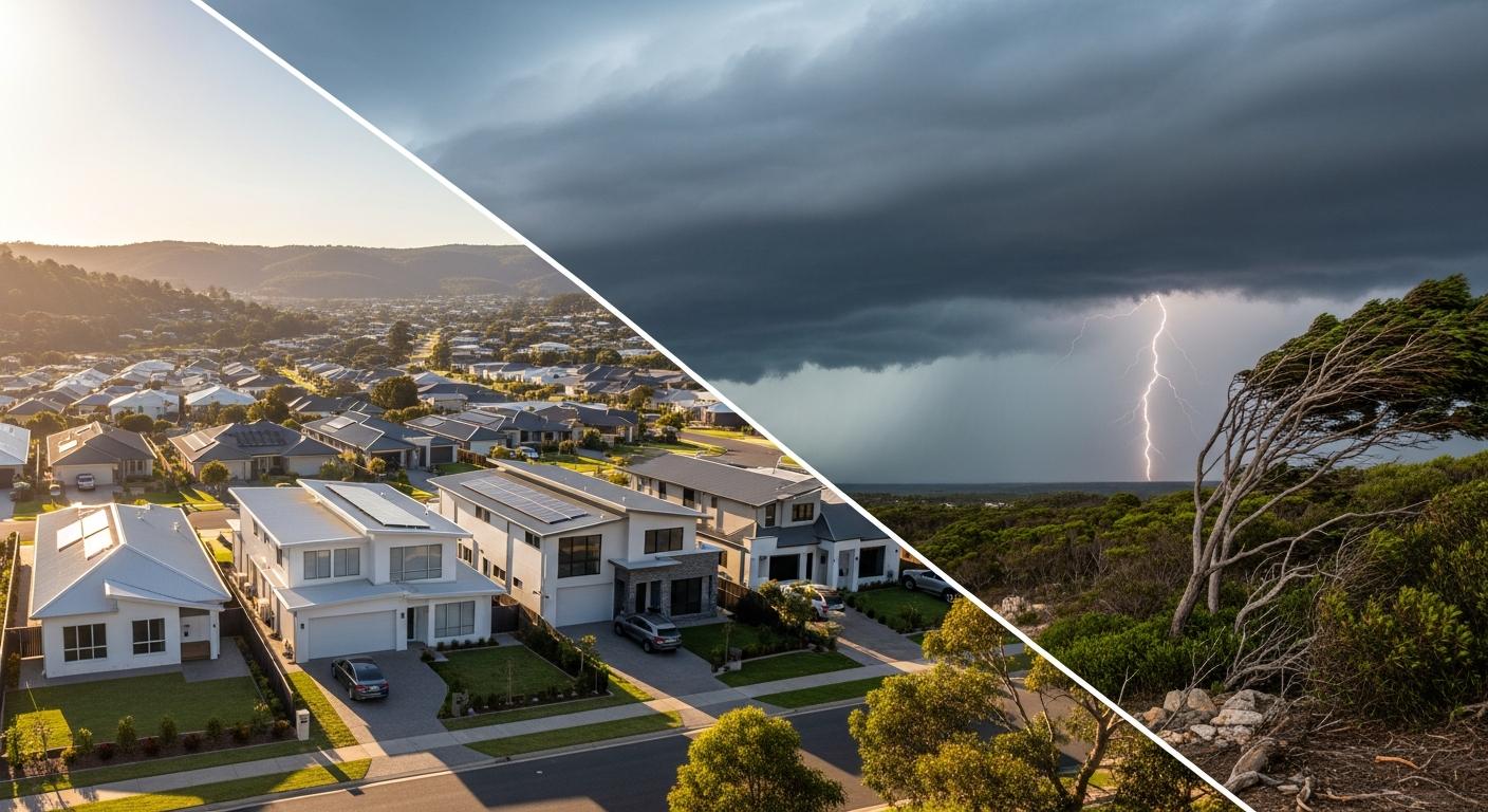
Climate risk is no longer a fringe concern for property investors — it's a pricing factor. In April 2026, with bushfire seasons intensifying, flood mapping being redrawn, and insurance premiums in some regions doubling over the past five years, the connection between environmental exposure and property values has never been more direct. And yet, most investors still don't factor climate risk into their due diligence.
This guide explains how environmental factors are reshaping Australian property markets, which risks matter most, and how to assess them before committing capital to any suburb or property.
Key Takeaways
- Insurance affordability is the primary mechanism through which climate risk affects property values — premiums in high-risk areas have increased 50–120% since 2020 in some regions.
- Flood, bushfire, and coastal erosion are the three climate hazards with the most direct impact on Australian residential property values in 2026.
- The Australian Prudential Regulation Authority (APRA) is increasingly requiring banks to account for climate risk in lending decisions, which may restrict borrowing capacity in exposed areas.
- Picki data shows that combining environmental risk assessment with traditional investment metrics like yield, vacancy rates, and population growth gives investors a far more complete picture of long-term risk.
- Properties in areas with lower climate exposure tend to command a growing price premium — estimated at 3–7% in comparable suburbs as of early 2026.
Why Climate Risk Matters for Property Investors Now
Australia has always been a land of weather extremes. But three converging forces are turning environmental exposure from a background consideration into a front-page investment risk:
1. Insurance Is Repricing Risk in Real Time
Insurance premiums are the most immediate way climate risk hits your hip pocket. The Insurance Council of Australia reported that average home insurance premiums rose 28% nationally between 2022 and 2025, but the increases are far from uniform. Properties in flood-prone postcodes in Northern Queensland, the Northern Rivers of NSW, and parts of Western Sydney have seen premium increases of 80–120%.
For an investor running cashflow calculations, an insurance bill that jumps from $2,000 to $4,500 per year fundamentally changes the numbers. It also affects net yield — sometimes dramatically.
2. Lenders Are Paying Attention
APRA's Climate Vulnerability Assessment, published in late 2025, required Australia's major banks to stress-test their mortgage portfolios against climate scenarios. While this hasn't yet resulted in postcode-level lending restrictions, the direction of travel is clear. Banks are building climate risk into their internal valuation models, and some non-bank lenders have already begun applying risk loadings to properties in high-exposure areas.
For investors, this means that financing conditions in climate-exposed areas may tighten over the next 3–5 years — affecting both your ability to borrow and the pool of future buyers when you eventually sell.
3. Buyer Sentiment Is Shifting
After the Lismore floods of 2022, the 2024 Victorian bushfire season, and repeated cyclone damage in North Queensland, buyer awareness of climate risk has increased measurably. CoreLogic data suggests that properties in flood-declared areas take 15–25% longer to sell than comparable properties outside the flood zone, even years after the event. This extended days on market pattern indicates a structural shift in buyer behaviour, not just a temporary reaction.
The Three Climate Risks That Matter Most
Flood Risk
Flooding is the most financially damaging natural hazard in Australia, accounting for approximately 30% of all insured disaster losses. The challenge for investors is that flood risk is being reassessed — councils are updating flood maps using new modelling that incorporates climate change projections, and properties that were previously outside the 1-in-100-year flood zone are being reclassified.
Key areas where flood risk repricing is most advanced:
- Northern Rivers NSW: Lismore, Ballina, and surrounding areas — post-2022 flood event, significant value reductions in flood-affected properties
- South East Queensland: Logan, Ipswich, and parts of the Brisbane River corridor
- Western Sydney: Hawkesbury-Nepean Valley — one of the largest flood-exposed populations in Australia
- Regional Victoria: Maribyrnong River catchment, parts of the Murray River system
Practical check: Before investing, obtain the flood mapping for the specific property — not just the suburb. Flood risk can vary dramatically within a single street depending on elevation and drainage.
Bushfire Risk
The bushfire season is lengthening across southern Australia, and the intensity of fires when they occur is increasing. Properties in designated Bushfire Attack Level (BAL) zones face specific construction requirements, higher insurance costs, and — in extreme cases — difficulty obtaining insurance at all.
BAL ratings range from BAL-LOW (minimal risk) to BAL-FML (Flame Zone — direct flame contact possible). Properties rated BAL-29 and above face significant additional construction costs for new builds or renovations, which affects the cost base for investors considering value-add strategies.
The suburbs most affected tend to be those at the urban-rural interface — the leafy fringe areas of cities like Sydney, Melbourne, Hobart, and Adelaide where housing meets bushland. Ironically, these are often the same areas prized for their lifestyle appeal, creating a tension between amenity value and risk exposure.
Coastal Erosion and Sea Level Rise
Australia has over 35,000 km of coastline, and coastal property has historically commanded significant premiums. But the combination of rising sea levels (approximately 3.5mm per year and accelerating) and increased storm surge intensity is placing some coastal properties at genuine long-term risk.
The Intergovernmental Panel on Climate Change (IPCC) projects 0.3–1.0 metres of sea level rise by 2100 depending on emissions scenarios. For low-lying coastal communities, this translates to increased flooding frequency, accelerated erosion, and potential loss of land.
Areas where coastal risk is most acute include:
- Parts of the Gold Coast and Sunshine Coast — narrow coastal strips with significant development density
- Port Phillip Bay foreshore (Melbourne) — low elevation with limited natural barriers
- South-east Tasmania — accelerating erosion in some coastal suburbs
- WA coastal communities — particularly those on sandy, erodible coastlines
How Climate Risk Affects Property Values: The Evidence
The relationship between climate exposure and property values is becoming measurable. Research from several Australian sources paints a consistent picture:
- Post-disaster value impacts: Properties directly affected by major flood events lose 10–30% of their value relative to unaffected comparable properties. This "flood stigma" persists for 5–10 years even after remediation.
- Insurance-driven affordability: When insurance premiums exceed $5,000–$7,000 per year for a standard residential property, buyer demand drops measurably. This threshold has been crossed in parts of North Queensland and the Northern Rivers.
- The "climate premium": Properties in demonstrably low-risk areas within a region are beginning to command a premium over comparable properties in higher-risk zones. Early estimates suggest this premium is 3–7% in markets where climate awareness is highest.
According to Picki's analysis, suburbs with strong investment fundamentals — high yields, low vacancy, growing populations — but significant climate exposure require a different risk assessment than those with similar metrics in lower-risk areas. The raw data may look identical, but the long-term risk profile is not.
How to Assess Climate Risk for an Investment Property
Here's a practical framework for incorporating climate risk into your property due diligence:
Step 1: Check the Hazard Maps
Every state maintains publicly accessible natural hazard mapping:
- NSW: NSW Planning Portal — flood and bushfire mapping
- QLD: Queensland Globe — flood, bushfire, and coastal hazard mapping
- VIC: VicPlan — bushfire and flood overlays
- WA: SLIP Portal — bushfire prone areas
- TAS: LISTmap — coastal erosion and flood layers
- SA: SA Planning Portal — natural hazard zones
Step 2: Get Insurance Quotes Early
Before committing to a purchase, obtain insurance quotes for the specific property. This is the single best indicator of how the market is pricing risk for that location. If premiums are significantly above the suburban average, there's an environmental risk factor that insurers have already identified.
Step 3: Review Council Planning Schemes
Local councils are increasingly incorporating climate adaptation into their planning schemes. Check for:
- Flood planning levels and freeboard requirements
- Bushfire Attack Level designations
- Coastal hazard management areas
- Any planned retreat or buy-back programs
Step 4: Assess the Trajectory
Climate risk isn't static — it's directional. An area that's currently low-risk may be trending toward higher risk as climate patterns shift. Look for:
- Whether flood maps are being updated (and in which direction)
- Trends in insurance pricing for the area over the past 3–5 years
- Council or state adaptation strategies that might indicate growing concern
Step 5: Factor Risk Into Your Numbers
If you proceed with a property in a moderately elevated risk zone, adjust your cashflow modelling to account for:
- Higher insurance costs (and potential for further increases)
- Possible future lending restrictions
- A discount to the assumed exit price if the risk profile worsens
- Longer selling periods when you eventually dispose of the asset
Climate Resilient Investing: What to Look For
Rather than just avoiding risk, savvy investors are actively seeking climate-resilient locations. These suburbs tend to share certain characteristics:
- Elevated topography: Properties above the 1-in-1000-year flood level with natural drainage away from the dwelling
- Established urban areas: Inner and middle-ring suburbs with mature infrastructure, concrete drainage, and emergency service proximity
- Diverse economies: Suburbs and LGAs where the local economy doesn't depend on climate-sensitive industries (agriculture, tourism). Areas like Blacktown in Western Sydney benefit from diversified employment across healthcare, retail, and logistics.
- Strong council finances: LGAs with the fiscal capacity to invest in climate adaptation infrastructure — stormwater upgrades, coastal defences, urban tree canopy
- Low insurance costs: Suburbs where standard insurance premiums are at or below the national average, indicating low hazard classification
The regional versus metro investment analysis takes on additional nuance when climate risk is considered. Some regional areas offer outstanding yield and growth fundamentals but carry elevated environmental exposure that metro areas don't face. This doesn't mean avoiding regional investment — it means being selective and informed.
What's Coming: Policy and Market Shifts on the Horizon
Several developments in 2026 and beyond will further embed climate risk into property markets:
- Mandatory climate risk disclosure: The Australian Sustainability Reporting Standards (ASRS), effective from 2025, require large companies and financial institutions to disclose climate-related financial risks. This is expected to cascade into mortgage lending and property valuation practices.
- Updated building codes: The National Construction Code is progressively incorporating climate resilience requirements, affecting new builds and major renovations.
- Local government adaptation plans: Many councils are developing or implementing climate adaptation strategies that may include rezoning, development restrictions, or managed retreat in extreme cases.
- Green finance incentives: Several lenders now offer discounted rates for energy-efficient homes, and this is expected to expand. Properties with high energy ratings, solar installations, and resilient design features may attract financing advantages.
Integrating Climate Assessment With Picki's Metrics
Picki's suburb-level data provides the investment fundamentals — yield, growth, vacancy, population trends, and more. Climate risk adds another dimension to that analysis. Here's how to use them together:
- Screen with Picki: Use the suburbs explorer to identify areas that meet your investment criteria across traditional metrics.
- Overlay hazard data: For each suburb on your shortlist, check state hazard maps for flood, bushfire, and coastal exposure.
- Validate with insurance: Obtain premium indications for representative properties in each suburb to quantify the risk cost.
- Adjust your ranking: Factor environmental exposure into your final suburb ranking. Two suburbs with identical Picki scores but different climate risk profiles are genuinely different investment propositions.
- Monitor over time: Climate risk evolves. Revisit the hazard assessment for your portfolio properties annually, particularly after major weather events or map updates.
For a deeper understanding of how different metrics work together, see our guides on owner-occupier ratios and median price interpretation — both of which take on additional context when environmental factors are considered.
Ready to start screening suburbs with comprehensive data? Create a free account and explore Picki's suburb-level metrics to build your research shortlist — then layer in the climate assessment framework above to make more resilient investment decisions.
Frequently Asked Questions
Can I still get a mortgage for a property in a high-risk climate zone?
Currently, yes — Australian banks haven't implemented postcode-level lending restrictions based on climate risk. However, valuations in high-risk areas may come in lower than expected, and some lenders are beginning to factor environmental exposure into their risk assessments. The practical impact is more likely to appear as lower loan-to-value ratios or higher rates in certain areas rather than outright refusal. This is expected to evolve over the next 3–5 years as APRA's climate risk frameworks mature.
How much do insurance premiums affect net rental yield?
In low-risk areas, landlord insurance typically costs $1,200–$2,500 per year for a standard residential property. In high-risk zones, this can climb to $5,000–$10,000 or more. On a $500,000 property yielding 5% gross ($25,000 rent), the difference between $2,000 and $7,000 in insurance represents a 2 percentage point reduction in net yield — the difference between positive and negative cash flow for many investors. Always obtain insurance quotes before finalising your investment analysis.
Are government buy-back programs a realistic risk for my investment?
Government buy-back programs remain rare in Australia, though the precedent set in Lismore (NSW) after the 2022 floods shows they're possible in extreme cases. The Resilient Homes Fund offered voluntary buy-backs, house raising, or retrofitting for eligible properties. While widespread implementation is unlikely, investors in areas that have experienced repeated severe events should be aware of the possibility and factor it into long-term planning.
Does climate risk affect rental demand, or just property values?
Both. In areas that have experienced major natural disasters, rental demand often spikes in the short term (displaced residents need temporary housing) but can decline over the medium term as residents relocate to lower-risk areas. Post-disaster population outflows have been documented in several flood-affected Australian communities. For investors, this creates a complex dynamic — short-term rental income may be strong, but long-term tenant demand may be at risk.
What's the best way to future-proof my property portfolio against climate risk?
Diversification is the most effective strategy. Spread your portfolio across different geographies, climate zones, and risk profiles so that no single climate event can significantly impact your total portfolio. Within individual properties, prioritise locations with low hazard classifications, invest in resilience measures (e.g., flood-resistant materials, bushfire-compliant landscaping), and regularly review your insurance coverage. Think of climate risk management as an ongoing process rather than a one-time assessment.
